En Ru
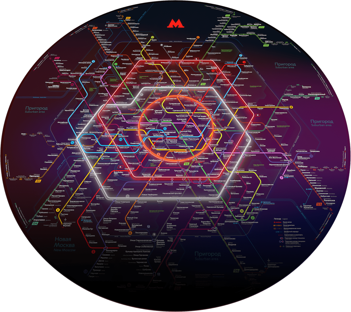
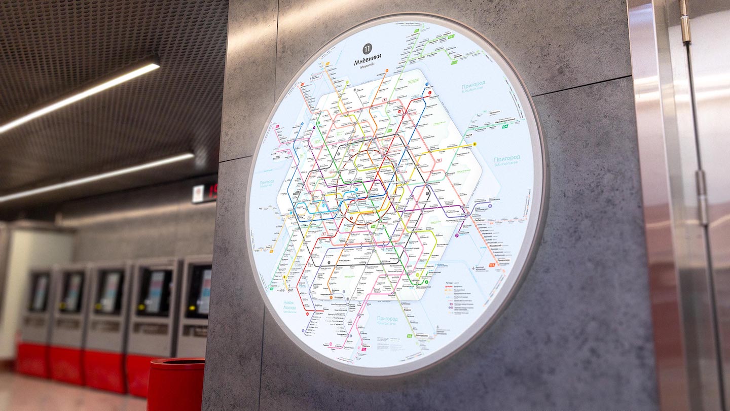
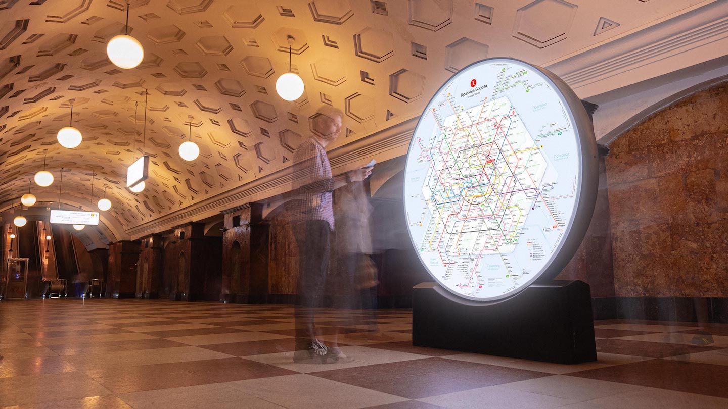
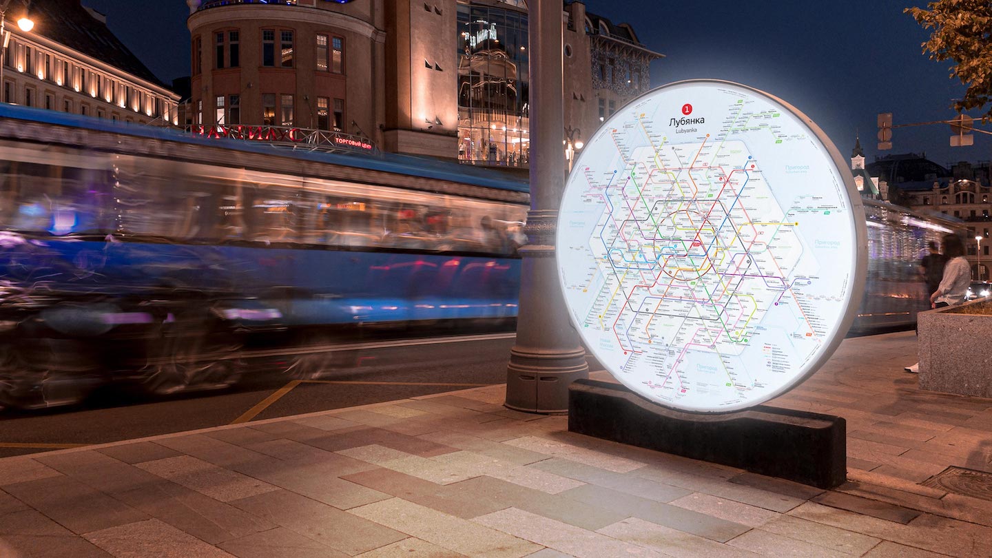
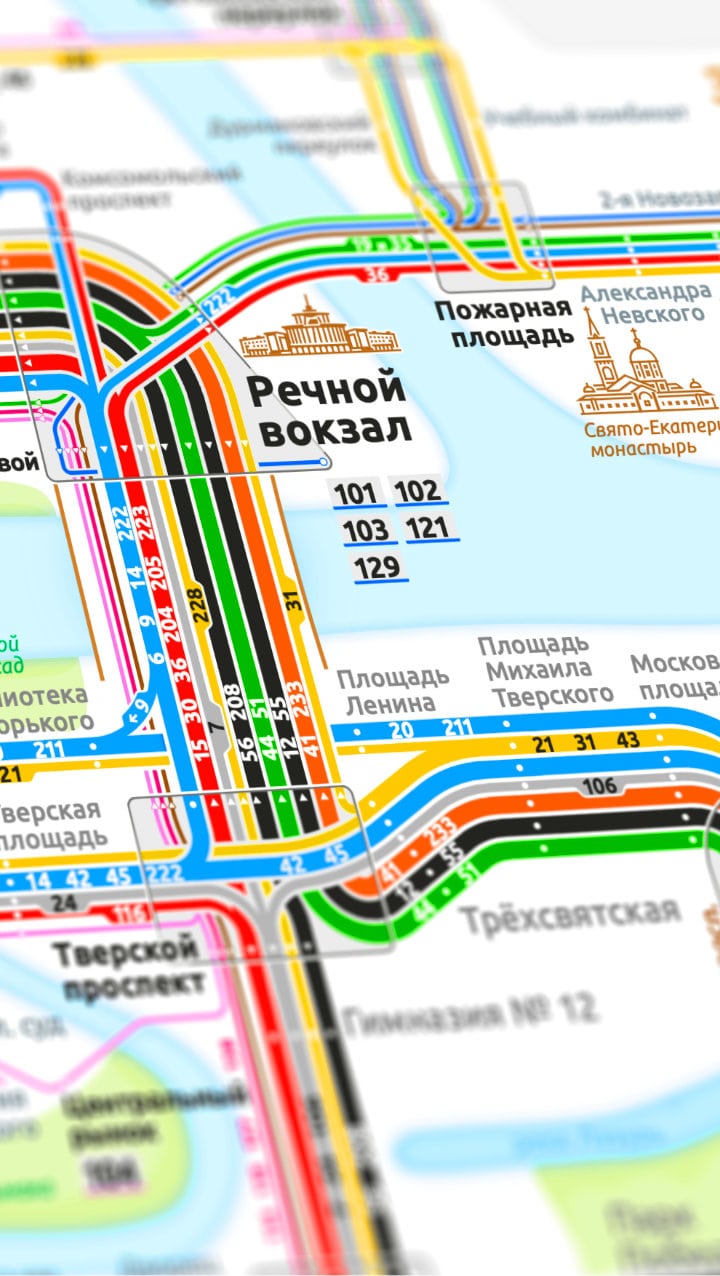
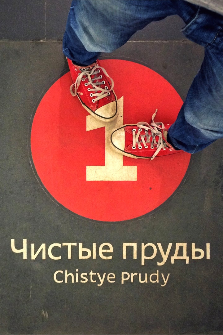
Creating a Moscow Metro map is one of the most complex design challenges imaginable. The Moscow Metro can be compared to a tangled ball of threads that you have to unravel to figure it out. We designed the map in collaboration with Natasha Moskaleva, based on long-term development plans for the construction of the Metro. It shows what the Moscow Metro will look like in 2030s. More information about the map can be found on the project’s website.
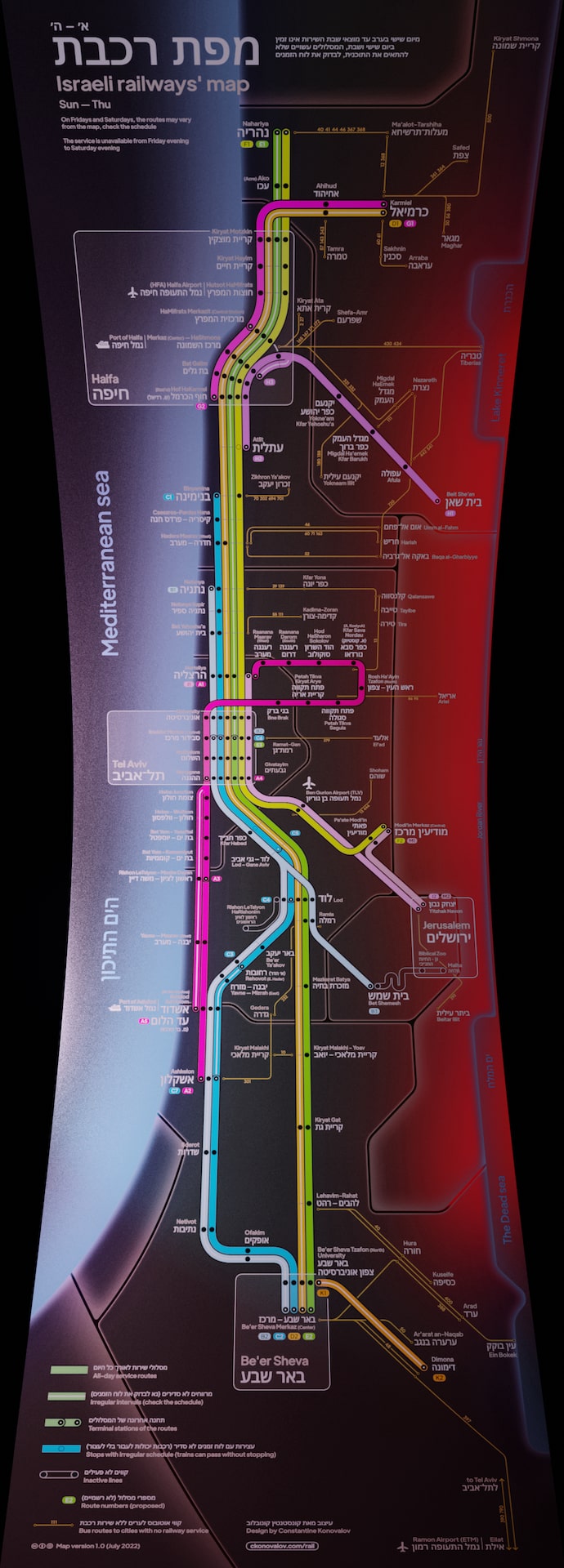
Israeli
railways’
map
Personal project・2022—2024
Israeli cities are connected by railroad running along the sea shore. Some cities can only be reached by bus. I designed a new Israeli railways’ map that includes bus routes to major cities with a population of 20 000+ people. The map’s design is based on a classic 45-degree graphic grid. The geography of the country is simplified to a vertical rectangular format bounded by the Jordan River on the right and with the Mediterranean Sea shore on the left. For the convenience of the users the distance between the stations roughly corresponds to the real map. This allows the cities within agglomerations to be visually combined together. Permanent routes are visually separated from those that only run during the rush hour or on a special schedule. The map also shows shorter versions of each route within every line, which is not represented on the official map.
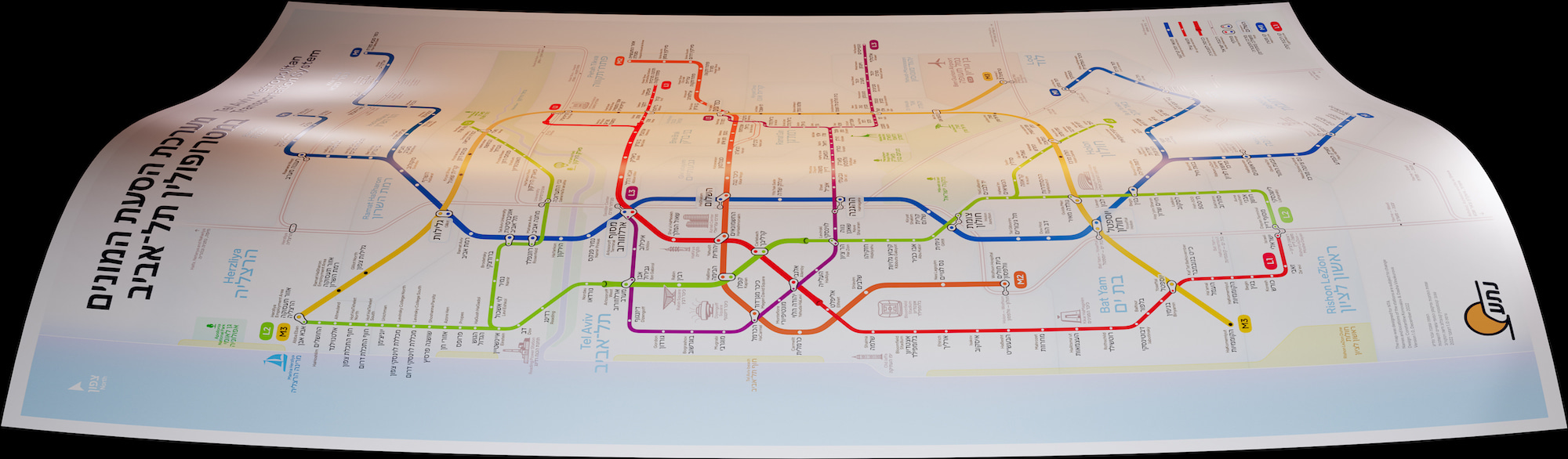
The Map of Tel Aviv Metropolitan
Transportation System
For Metropolitan Mass Transit System Ltd (NTA)
In collaboration with Daria Vinokurova・2023—2024
A new transportation system is under construction in Tel Aviv, consisting of three subway lines and three light rail lines. It will connect Tel Aviv with the rest of Dan area through fast and comfortable public transportation. The project is very ambitious and highly anticipated in Israel. NTA, the company in charge of its design and construction, approached us for a new map of the system that would clearly and vividly show its structure to future users. The map represents the final state of the system. By the time the map was created, the red line had already been built and was being prepared for launch, and the green and purple lines were under construction.
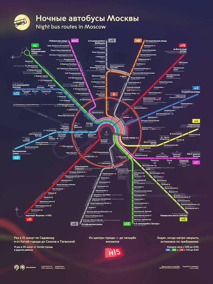
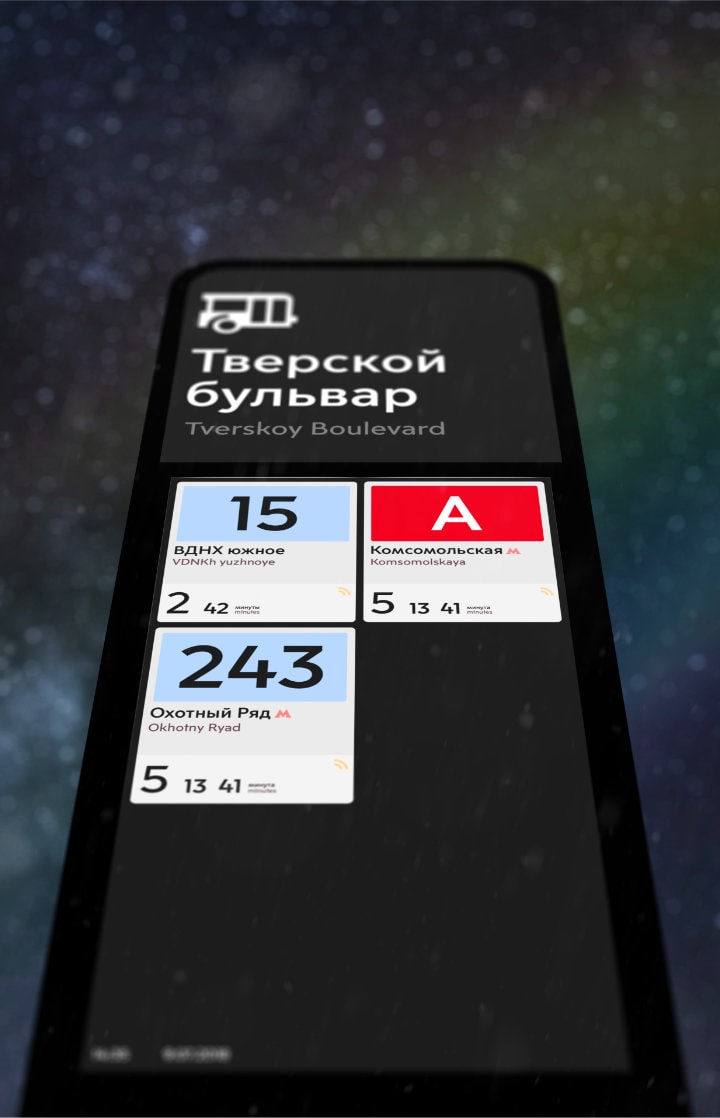
Night bus
routes map
For the Department of Transportation of Moscow・2016—2022
Since the Moscow Metro does not work at night, night bus routes were launched in 2013 as an alternative. The route network partly duplicates the Metro lines: 14 routes depart from the city centre and go to the residential areas, and one extra circle route goes around the centre along the Garden Ring.
Striving to improve the readability of the map, I simplified the geometry of the city by straightening the lines just like it was done on the Metro map, so I got 14 rays diverging from the centre. In the centre of the map, I worked out the geometry, so that a complex interchange area looked as simple and impressive as possible.
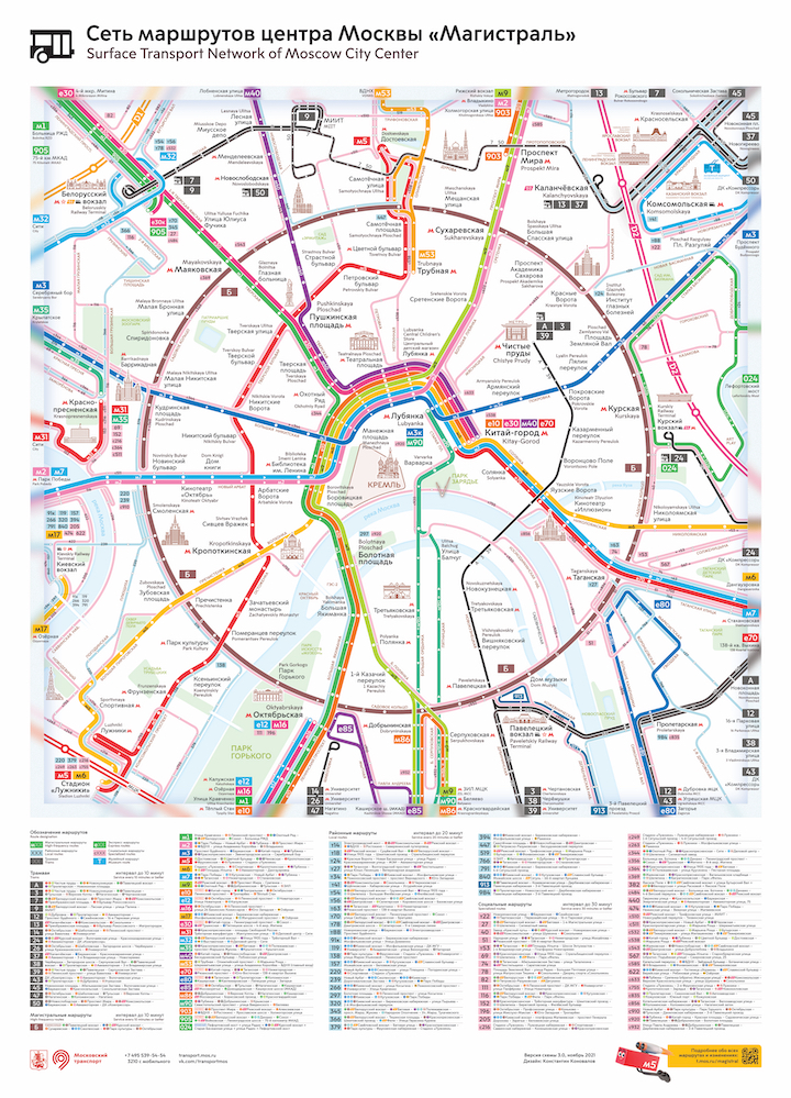
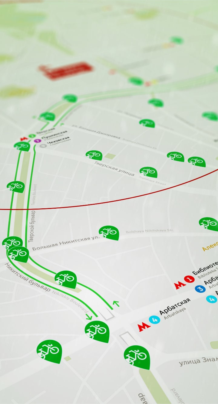
Map of the
central Moscow bus network
For the Department of Transportation of Moscow・2016—2021
In 2016, a new bus route network called “Magistral” was launched in the Moscow city centre, which significantly improved the availability of ground public transport in the city. New arterial routes started to run at regular intervals. I designed a route map for this project.
To make the map look elegant, I used a 15° graphic grid. It allowed me to show the routes more accurately: they were close to the geography of the routes visually, but at the same time, a strict grid preserved the graphic clarity of the map. I continued my work on this project for a long time, updating the map, improving it visually and testing various graphic approaches based on what I learned from field testing and user reports. The map is now displayed at every bus stop in central Moscow.
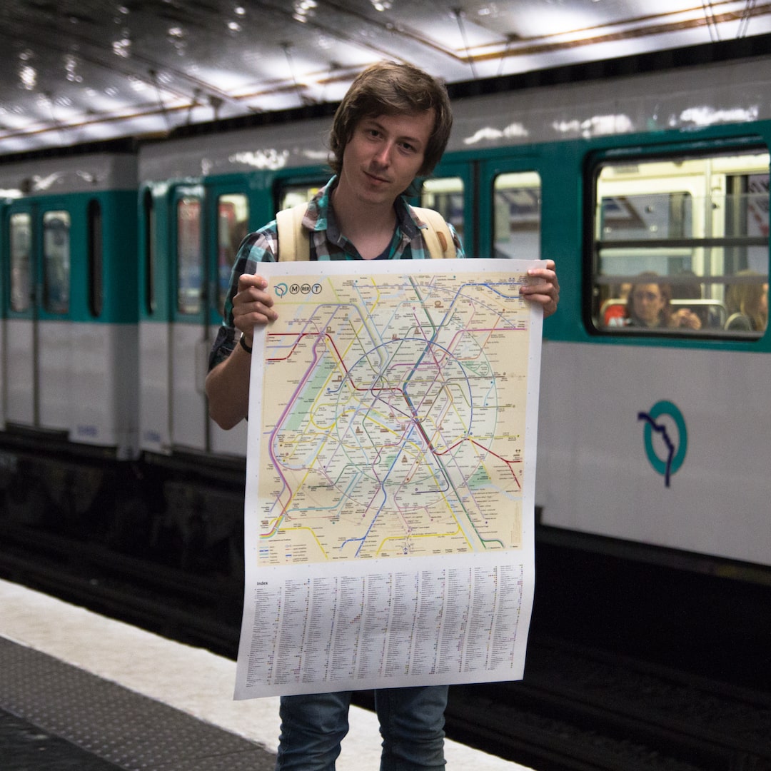
New Paris
Metro map
Personal project・2013—2024
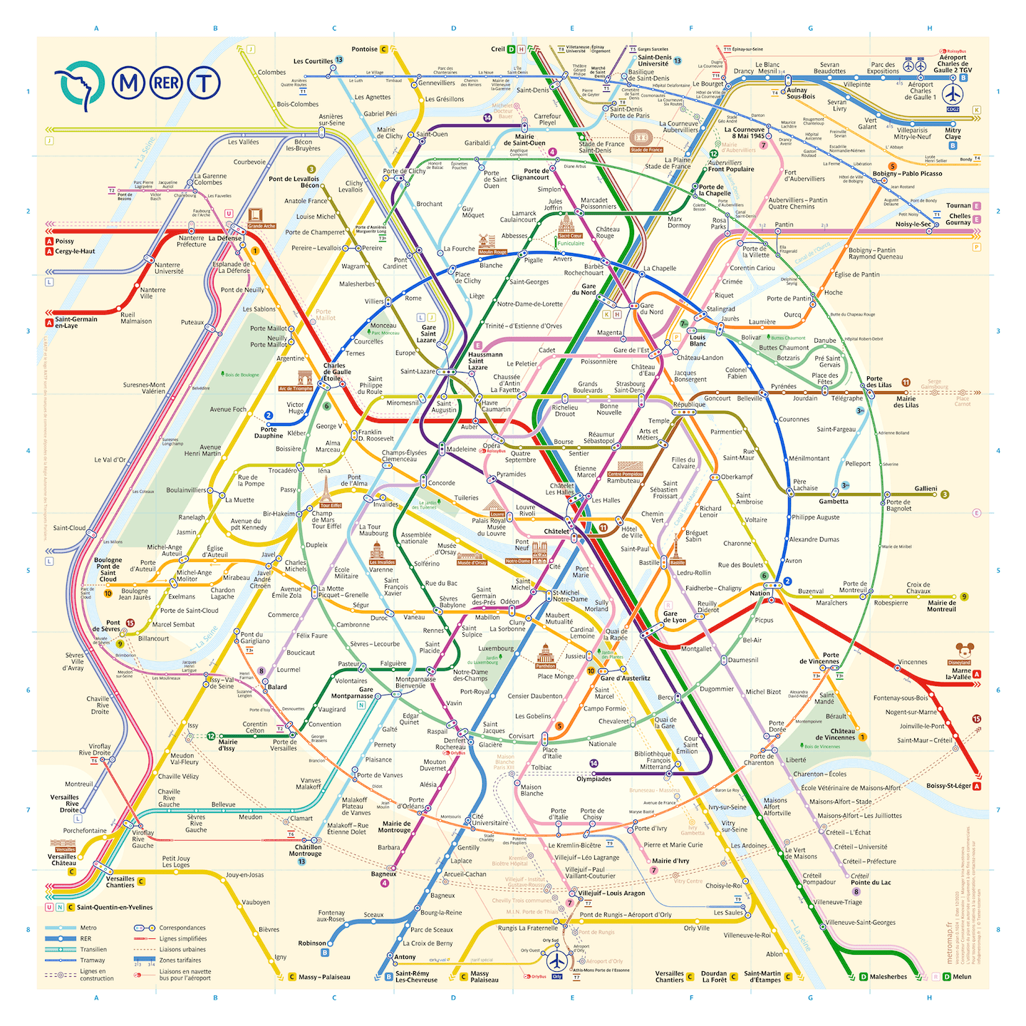
In 2013, I lived in Paris for several months and fell in love with the Paris Metropolitaine — it is old but so cozy. I disliked the official metro map of the Paris subway. I found it chaotic and complicated, so I decided to draw my own version of the map. The project took about 2.5 years. In my free time, I tested various map design approaches. As a result, I got a map with a round circle line and a unique graphic grid of 60°.
Many Parisians liked the map; people buy it to hang on walls of their homes. The map’s website is visited daily by thousands of Parisians and visitors to the city who need to plan their journey. I wrote a big article about the map’s design process for Smashing Magazine. While working on this project, I truly fell in love with the process of transit map design.

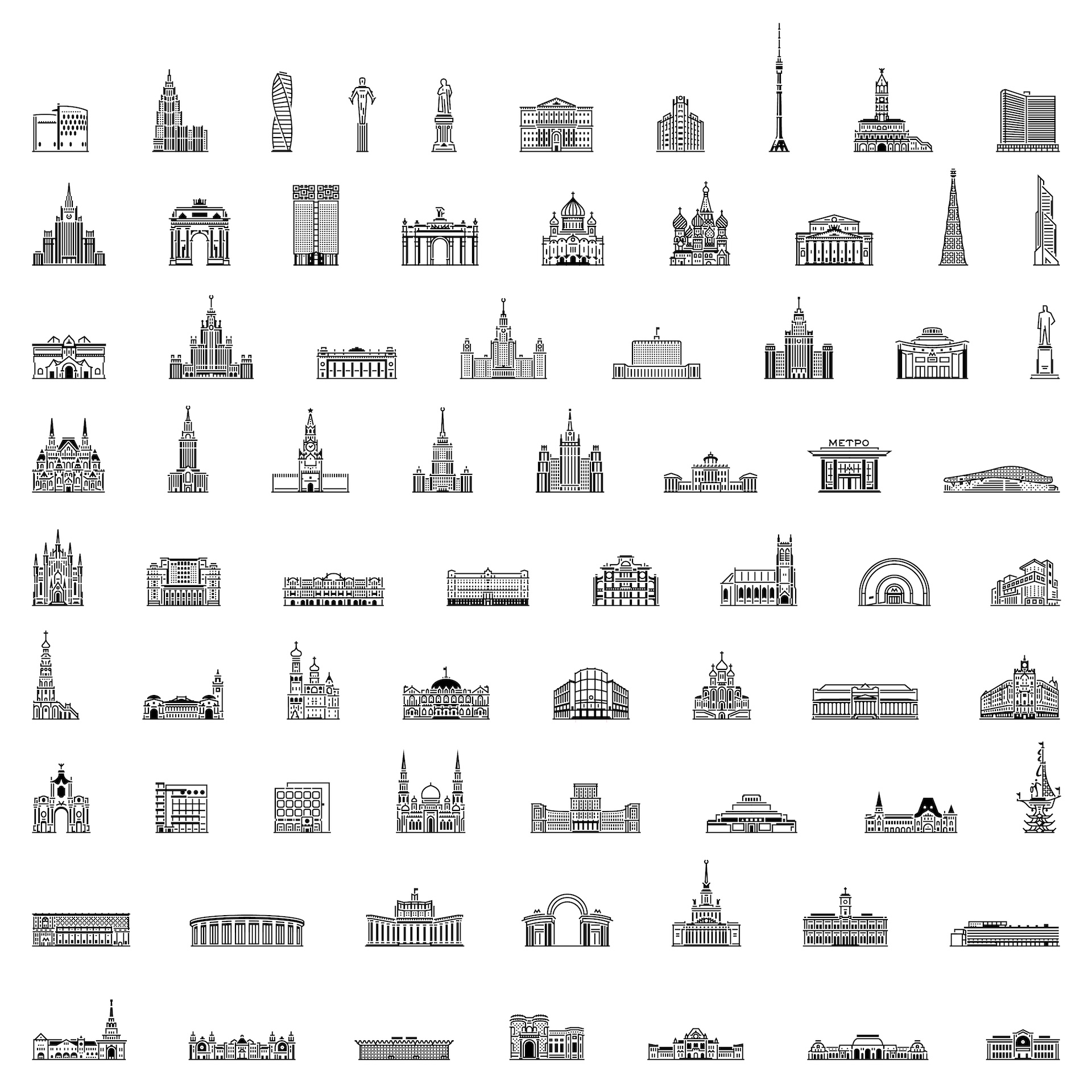
Pictograms
of Moscow
Personal project ・2017—2020
Moscow offers a huge variety of attractions of different historical eras. I drew about 100 of the most recognisable buildings of the city in a uniform style. Today these pictograms are used on Moscow maps, transit schemes and other elements of wayfinding. While working on the project, I tried to preserve the recognisable proportions of the buildings and to convey the details. The uniformity of the pictograms makes it practical to use the entire set in various projects. Thanks to their conciseness and easy recognition, they look extra good in small size on maps, diagrams and similar formats.
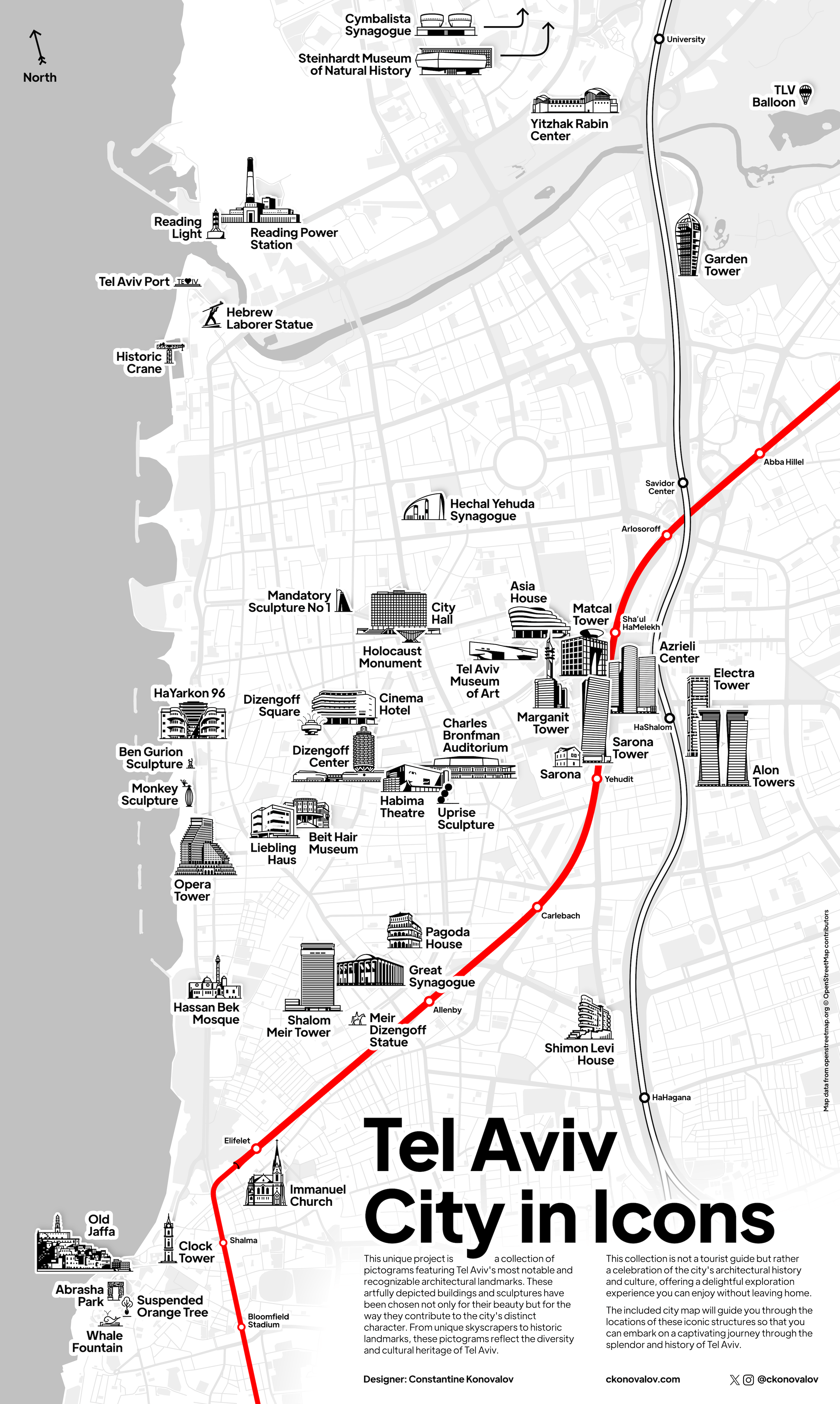
Pictograms
of Tel Aviv
Personal project ・2022—2024
Tel Aviv is an amazing young city, which, despite its relatively short history, possesses a unique architectural identity. After moving from Moscow to Tel Aviv, inspired by the success of my Moscow icon project, I decided to create a similar collection of icons for this city. This poster sparks keen interest among tourists: some recognize buildings they’ve seen before, while others are curious about the new ones. To enrich their experience, I developed a special hint map marking the location of each depicted object. This allows travelers to easily plan their routes and ensures they don’t miss any of the most interesting places.
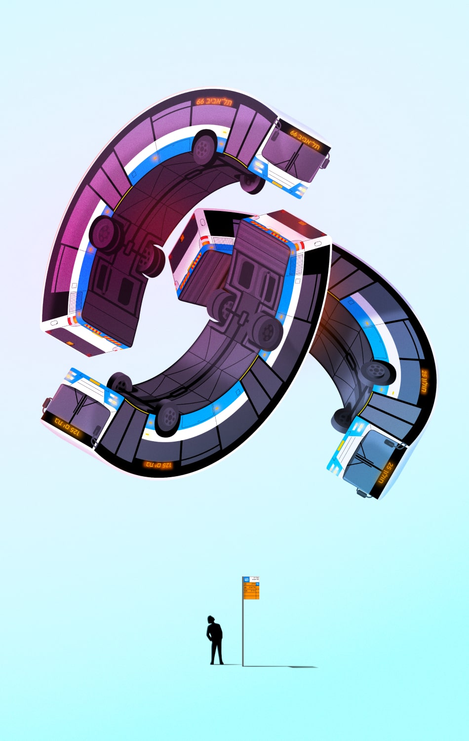
Illustrations
I participate in art exhibitions throughout Israel, presenting my view of the world through art. I am particularly passionate about vector 3D illustrations, where I can work with bright colors and smooth gradients. The illustration below reflects my first impressions of Israel’s public transport when I had just moved to Tel Aviv. The typical stilted houses of Israeli architecture, in my imagination, turned into spacecraft that had just landed on Earth.


Moscow Metro logo
For the Moscow Metro・2013—2014
In collaboration with Art.Lebedev Studio
The Moscow Metro’s logo in the form of a letter “M” emerged simultaneously with the opening of the subway in 1935, but for a long time there was no standardised; in fact, the logo changed its shape often and quite chaotically. I conducted the research and studied the history of the Metro symbol, and later we designed a standardised logo based on the historical image of the symbol in collaboration with Art.Lebedev Studio. The updated sign became the official logo of the Moscow Metro. I described the design process in detail at the Art.Lebedev Studio website.

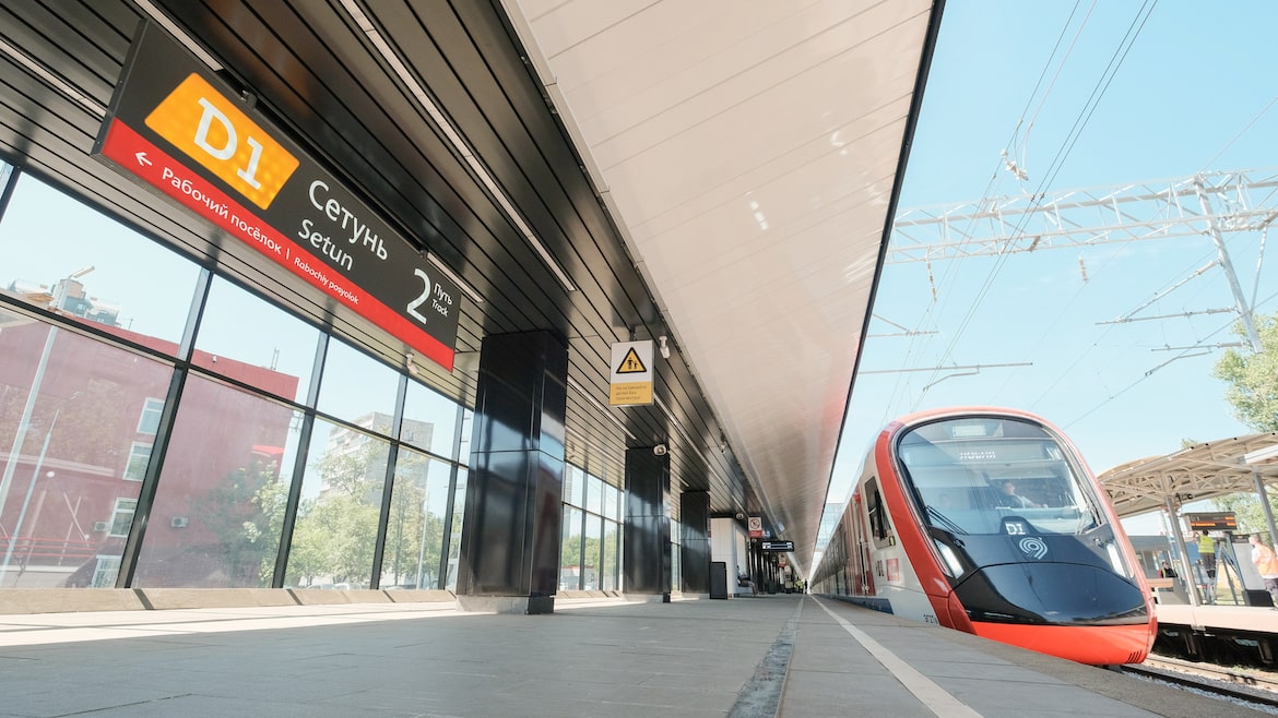
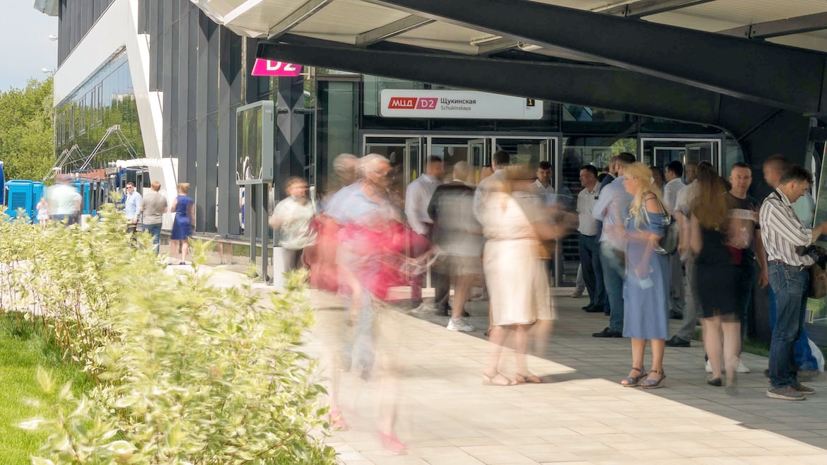
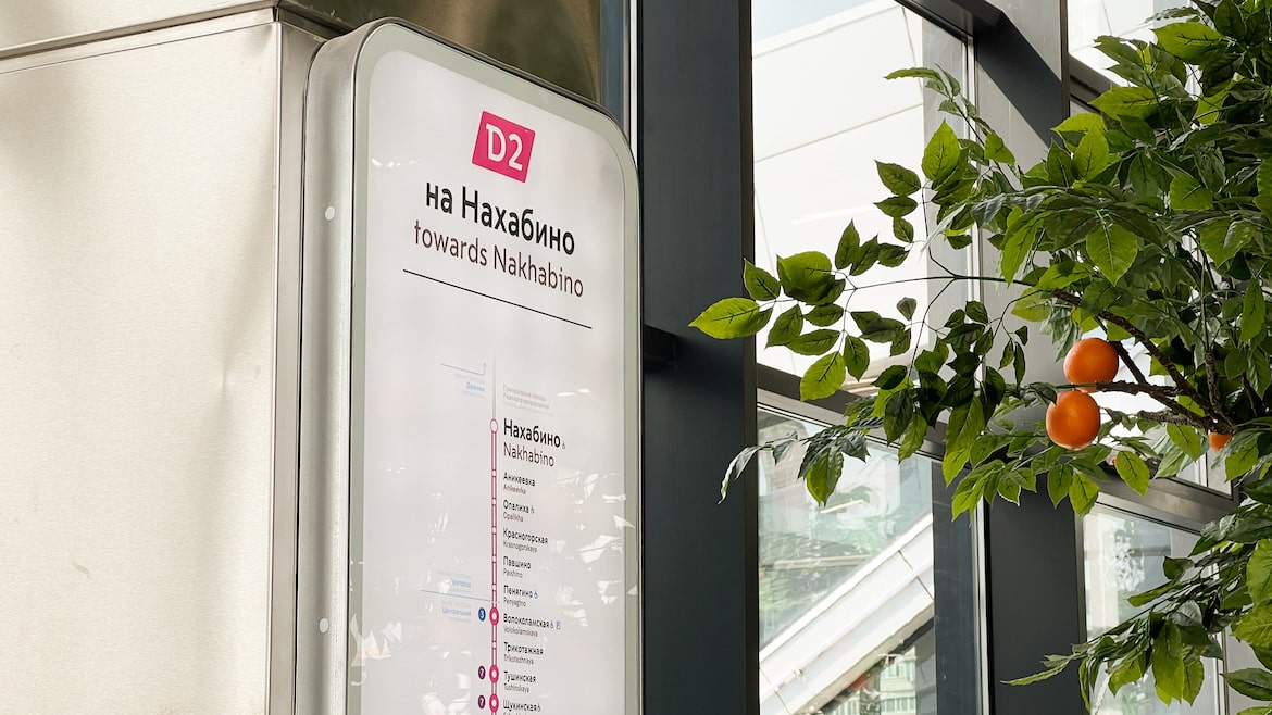
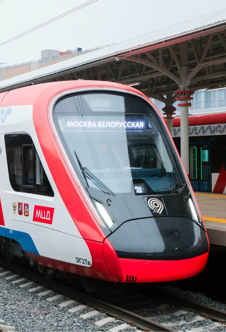
MCD logo
For the Department of Transportation of Moscow・2018
In 2019, the Moscow Central Diameters were launched in Moscow. It is an analogue to Berlin’s S-Bahn or Parisian RER: pre-existing railway lines are integrated into the subway system to improve transit connectivity between the central city and the suburbs. I designed an official logo for the new service.


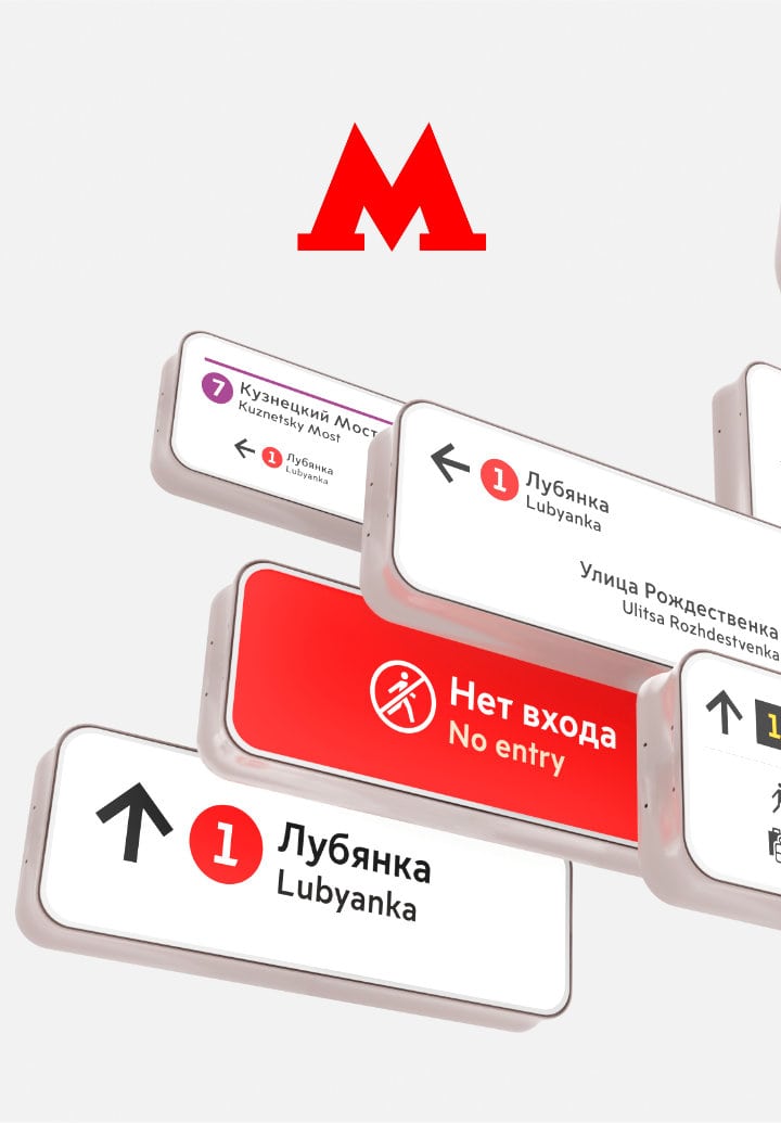
Signs for the MCD lines
For the Department of Transportation of Moscow
In collaboration with Natalia Moskaleva・2019
The new MCD service needed not only a logo, but also the signs to indicate five new lines. The goal was to design signs that will blend in with the icons of the metro lines, but at the same time stand out to show that the MCD is a separate entity. Graphically, the signs are similar to the MCD logo due to the same shape, so it is easier for passengers to understand what service they represent. We selected unique colours for the signs that have not yet been used on the metro map. We also studied the prospects of the development of the subway system in order to choose the right colours so that lines with similar colours don’t intersect with each other on the map in the future.
Photos: Sasha Derivanov
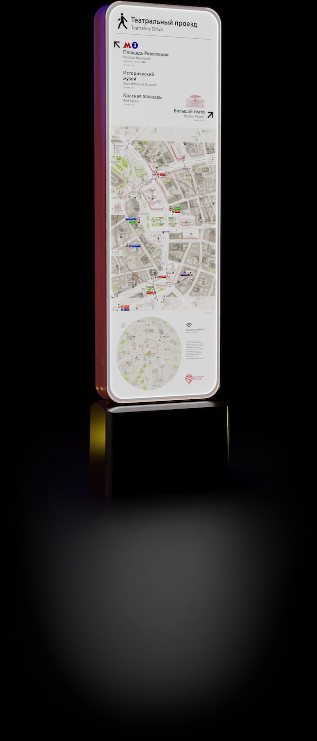
Pedestrian wayfinding
in Moscow
In collaboration with the team of the Department
of Transportation of Moscow・2016—2018
In 2016, we designed the pedestrian wayfinding stands in collaboration with the team of the Department of Transportation of Moscow. The stands contain all the information needed by tourists or Muscovites in an unfamiliar area.
Detailed large-scale maps showing the surrounding area are always rotated to match the direction of sight. This allows to quickly orient yourself in space without thinking where north and west are. We created stands of different widths for various streets: narrow stands are used on small streets not to interfere with the passage, and wide “queen size” stands with a huge map are placed on the squares and in the parks, allowing to plan the most complex route.
Nowadays there are more than 1000 wayfinding stands in this design installed in the streets of Moscow.

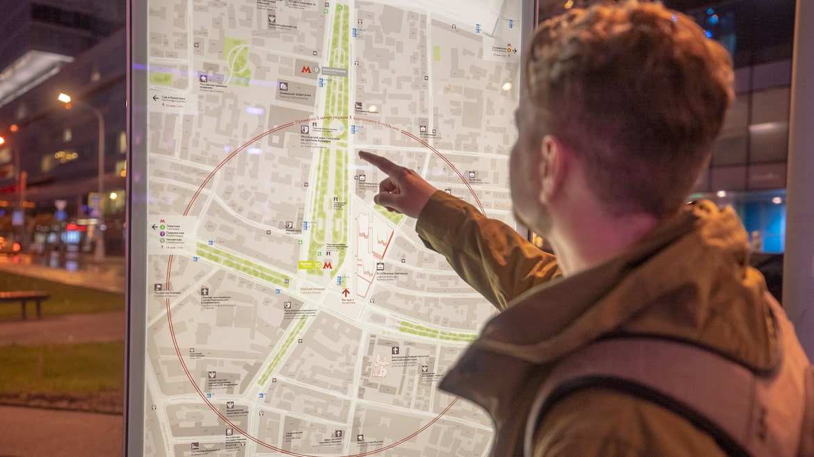
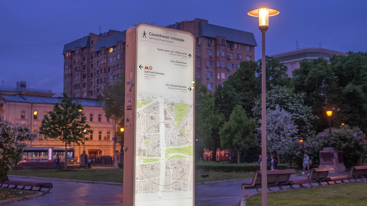
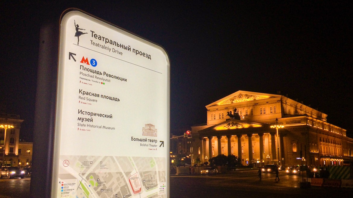
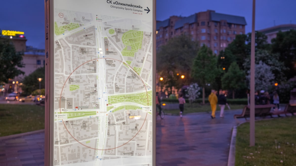
Photos: Alexey Solnyshkov
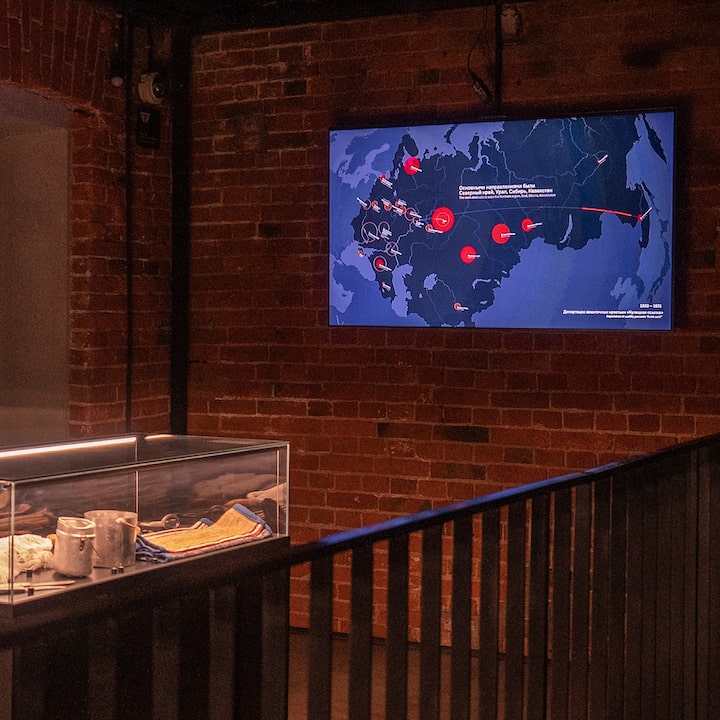
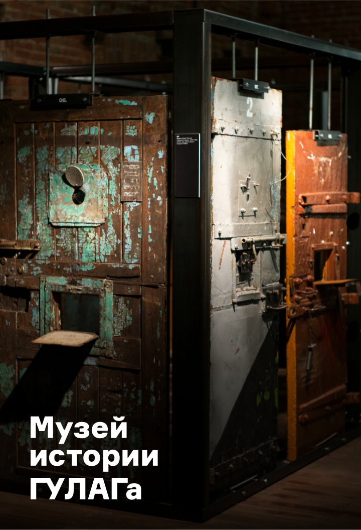
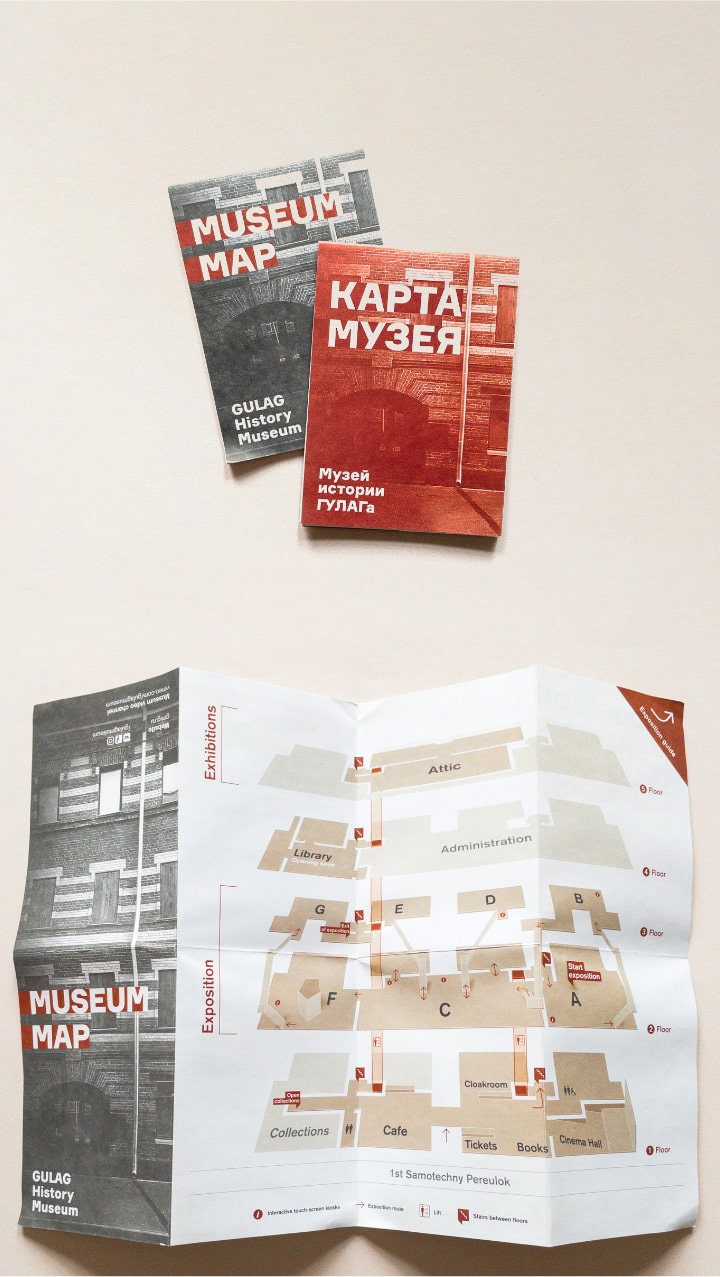
Design for the GULAG History Museum
2015—2018
For several years, I had been doing projects for the GULAG History Museum in Moscow. I visualised complex historical data both for the museum’s exposition and for external projects related to the history of Stalin’s repressions.
The map of the resettlements
of the peoples
When talking about the repressions in the USSR, we usually recall either the GULAG camps or the mass executions in the 1930s. However, another important component of the repressive machine of the era were the forced resettlements of the peoples. The relocations took place against the will of the people, based on their ethnicity, social class or political views. It was almost impossible to show the full scale of the migrations in a single frame (too many episodes of the resettlements happened simultaneously), so I decided to make a visual animation. Dots flash chronologically on the USSR’s map showing when and where people were forcibly resettled. The radius of the starting point represents the scale of the event: the more people were relocated, the larger the circle is. The map is part of the permanent exhibition of the museum.
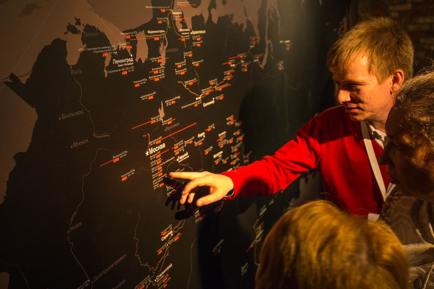
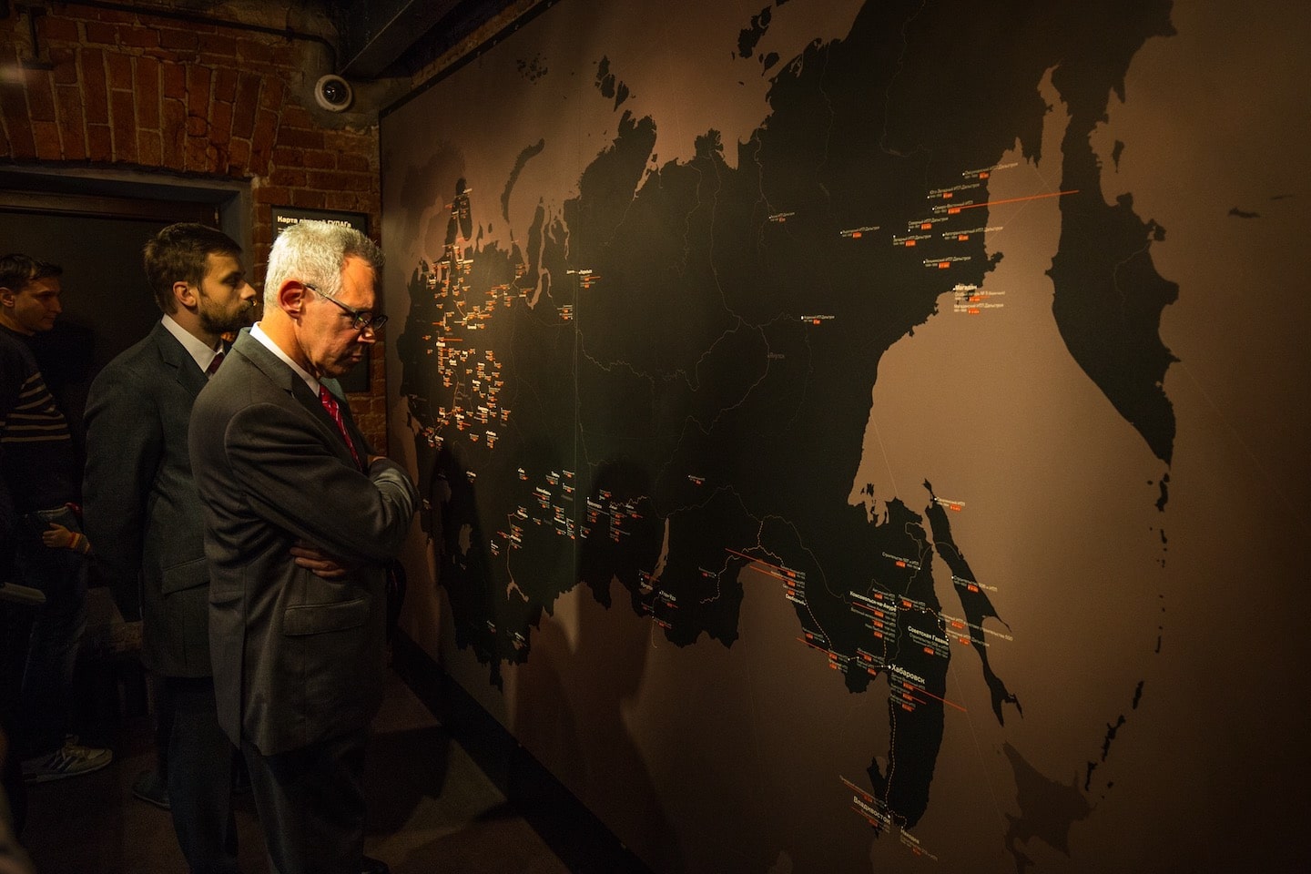
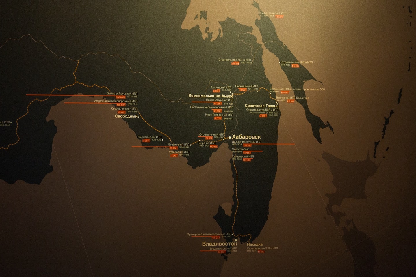
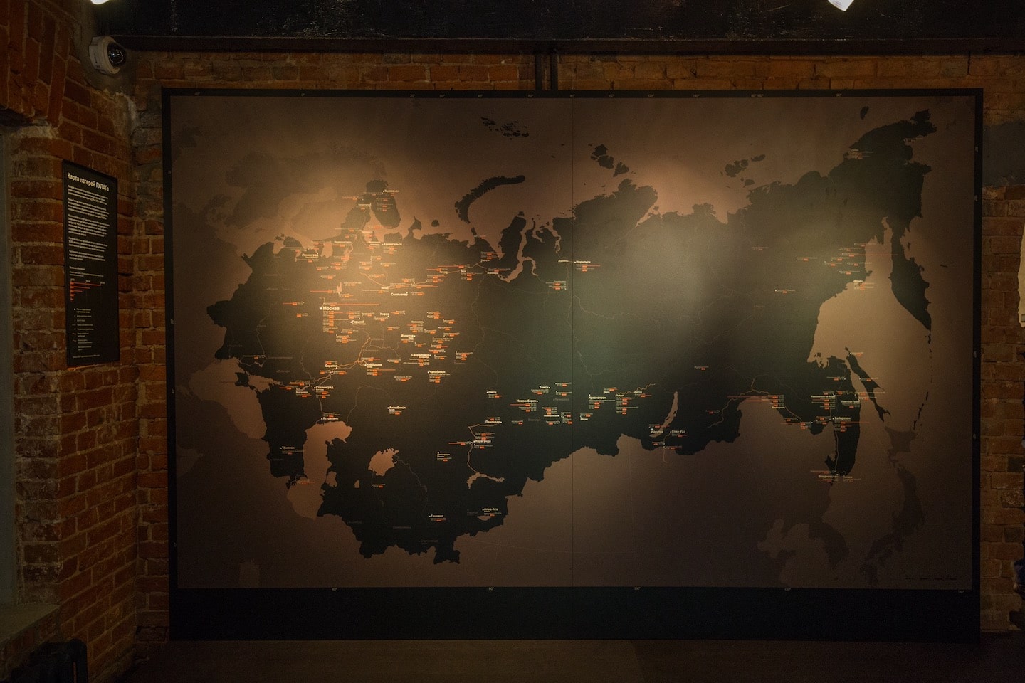
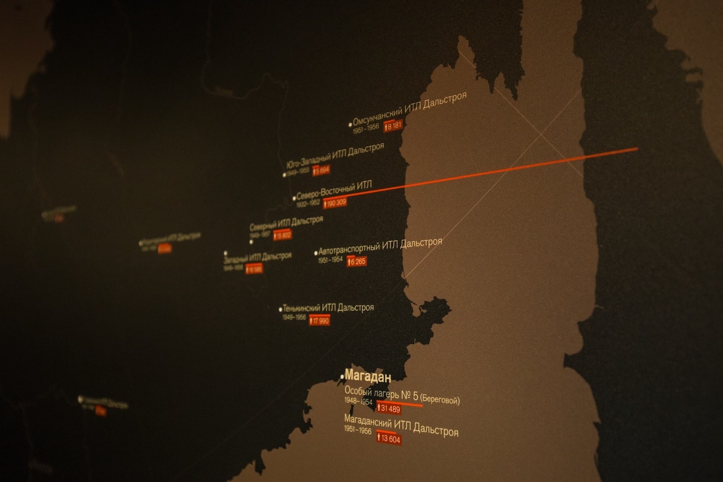
The map
of the GULAG camps
I visualised the geography of the forced labour camps in the USSR during the Stalin era in collaboration with the GULAG History Museum scientific team.
We collected data on the largest camps, each confining 5000+ people at a time. In order for the museum’s visitors to better understand the scale of the tragedy, I visualised the population of each camp based on the data from the museum’s scientific department. The red line at each camp represents the number of prisoners: the longer it is, the more people there were. We mounted the map in a way that the visitors can come close to it, find the city of interest and the camps next to it.
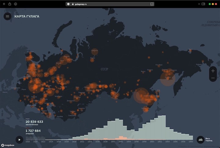
Two years later, we decided to convert the map to a digital format so that everyone could have access to the data online. In collaboration with the team of developers and map specialists form URBICA, we designed a website with a digital map of the camps. We added data on the number of the deaths in the camps and a timeline that allows to learn about the scale of the camp system throughout the years.
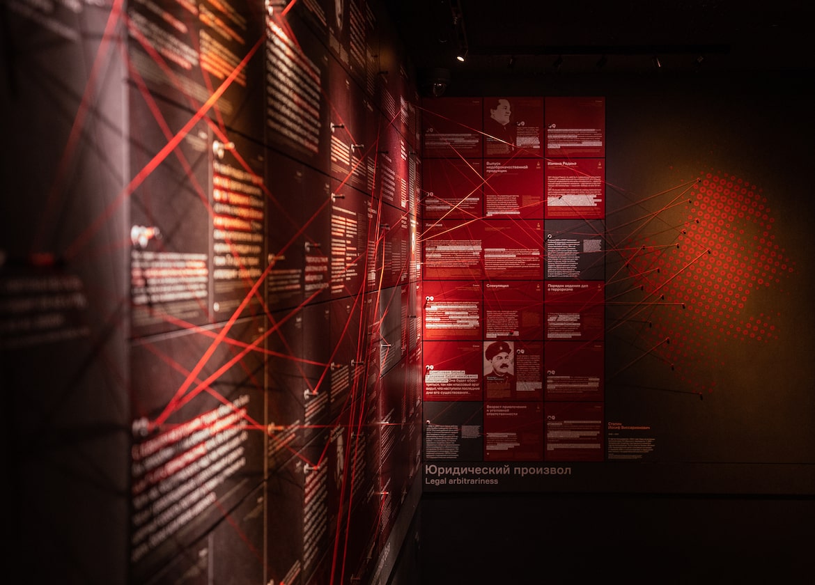
A fragment of the exposition of the GULAG History Museum that shows how the radical statements of the leaders of the Great October Revolution of 1917 gradually made way for the legal acts, and later for the repressive Stalinist laws of the 1930–1950s. On a large wall, we mounted quotes of political figures and fragments of legal documents in a chronological order. The most stringent laws that included long terms of imprisonment, exile of relatives and the death penalty as punishments, are placed on the right. The plaques are interconnected with red threads showing how particular statements and events could make way for the particular laws in the future. We used threads as the most appropriate visualisation of how political views and decisions of the leaders can lead to mass repressions against their own people.
The legal basis
of the repressions
in the USSR
In collaboration with Dasha Vinokurova
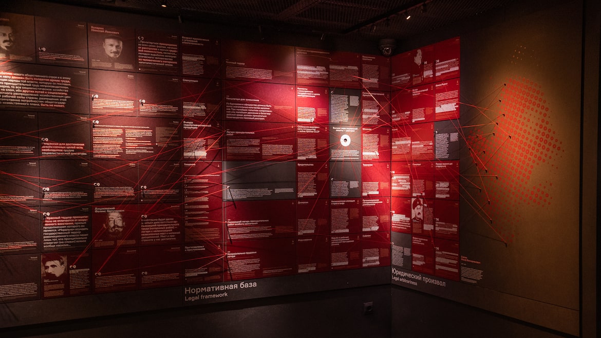
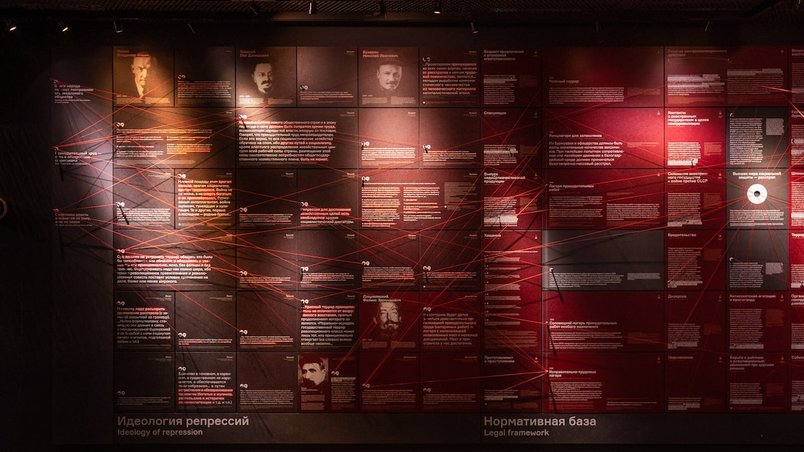
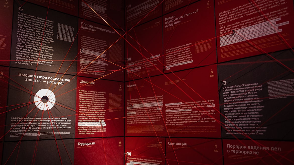
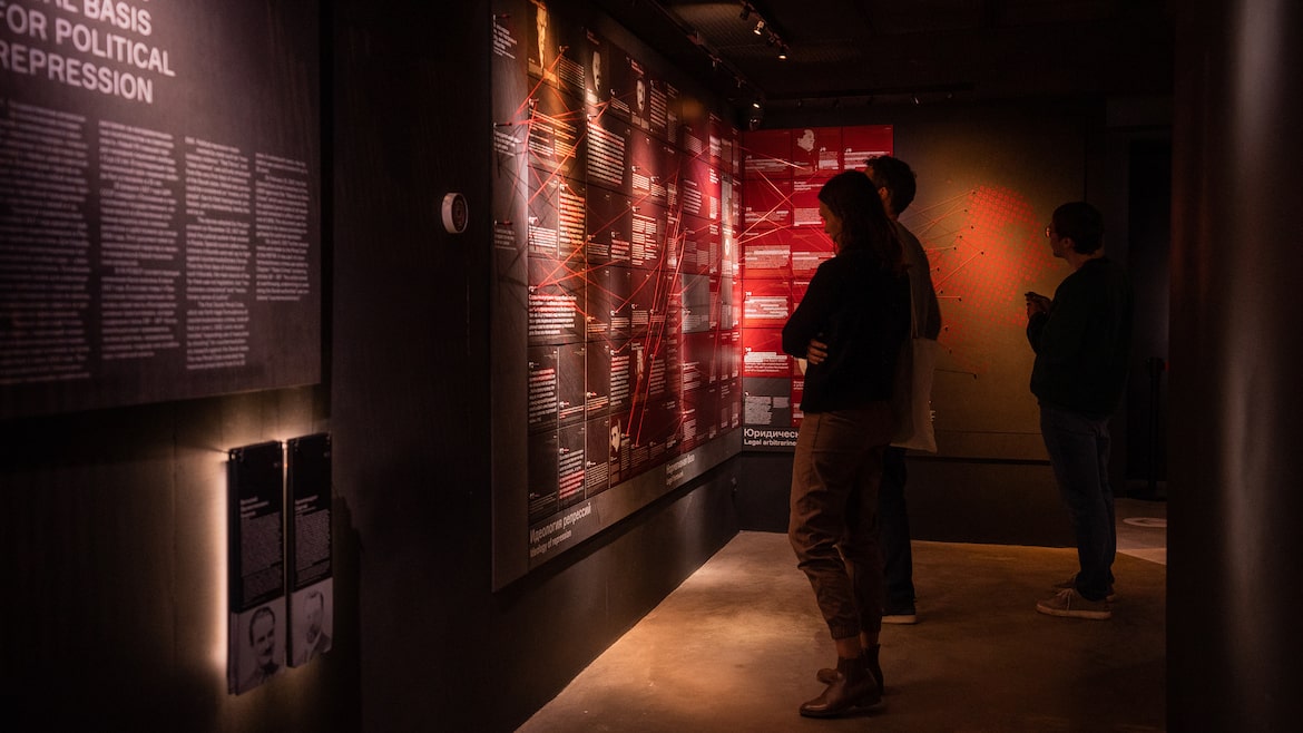
Photos: Alexey Solnyshkov
Stop-motion
animation

In collaboration with Irina Neustroeva, we founded a video production studio Teeter-Totter-Tam, where I used to shoot commercials and festival videos in a frame-by-frame and time-lapse animation techniques. From 2010 to 2018, we shot several works that participated in 40+ festivals and shows around the world. Stop-motion animation is a fairly complex process that requires attention to detail: each frame is a separate photograph, and fast-forwarding frames creates an illusion of objects coming to life.
More projects
I described the most significant and interesting projects in detail on this page above.
But there were lots of other fun projects.
About me
Today I live in Israel, but for almost all my life I lived in Moscow, hence there are so many projects about this city in my portfolio. I love to work on large and complex projects in the fields of pubic transport and museum design.
Work experience:
Independent Designer and Art Director
2017 — Now
Art director at the GULAG History Museum
2015 — 2017
Lead designer at the Department of Transportation of Moscow
2014 — 2016
Designer at Art.Lebedev Studio
2013 — 2014
Animation Director & Co-Founder at Tetter-Totter-Tam Animation
2010 — 2018
Education:
Bauman Moscow State Technical University
Electronic Equipment Design and Technology
2006 — 2012
Contacts